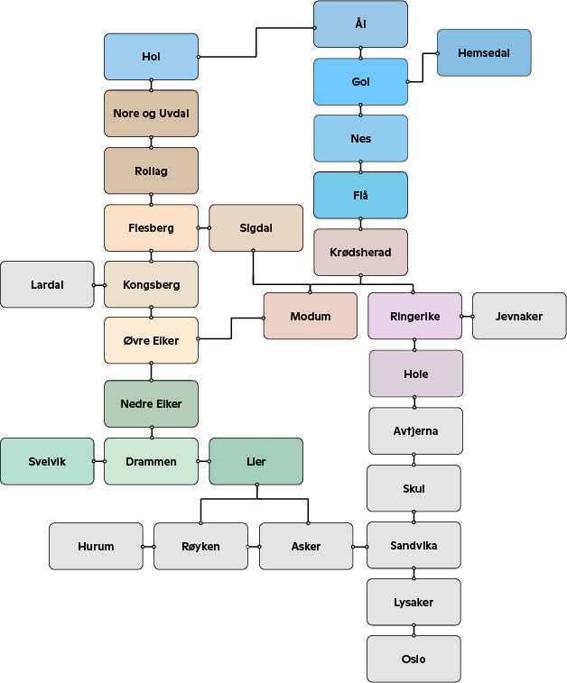
How to count zones: Your guide to the right price
Find your start and end zones: Locate the boxes representing where you board and where you get off.
Follow the line: See which boxes the line passes through between the two locations.
Count every box: Every box the line touches counts as one zone. Remember to include your starting zone, any gray boxes (zones outside Buskerud), and your destination zone.
There are 10 zones in total. You pay for the total number of zones the bus travels through on your route.
Why are some boxes gray? The gray boxes are zones located outside Buskerud (for example Asker, Sandvika, or Oslo) that our bus passes through. Even if you are not getting off in a gray zone, it must be counted if the bus travels through it.
Zone map:
 This diagram shows how our zones are interconnected. Since the bus often passes through several areas on its way to your destination, this is the most reliable way to determine how many zones you actually need to pay for
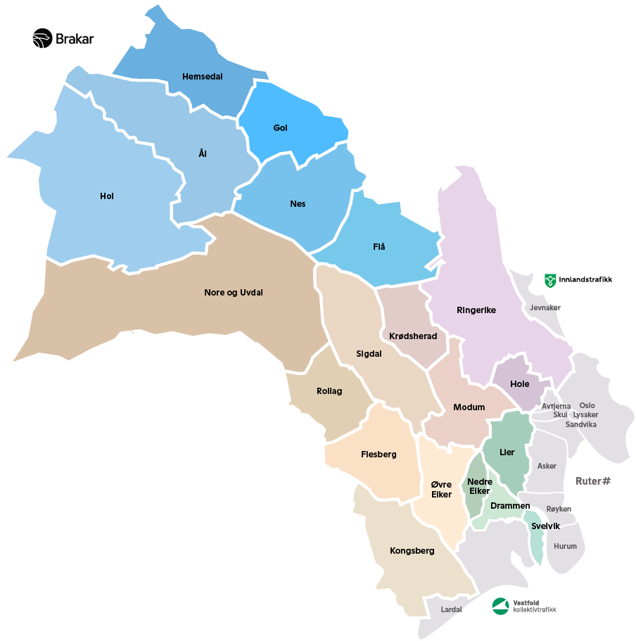
Geographic overview of zones
 This diagram shows how our zones are connected. Since the bus often travels through multiple areas on its way to your destination, this is the most reliable way to find out how many zones you actually need to pay for.